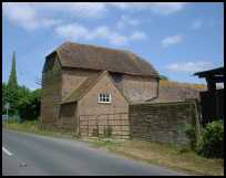
Piltdown in East Sussex is a collection of small hamlets on a down on the southern edge
of the Ashdown Forest , the area is one of heath land and shrubs.
The area near the golf course is claimed to have a Plague pit where
victims from the nearby villages Fletching , Maresfield and Newick
buried their dead when the Black Death struck in 1348 . This might
explain why the churches are still at the village centre unlike
Isfield where the church is a long way from the present village.
In 1912 a skull was unearthed by Lewes solicitor Charles Dawson, it had a
human head and an apes jaw. Dawson who was also a geologist and fossil
hunter discovered the skull close to some bones of elephants , hippopotamus
and beaver in a strata uncovered by a nearby stream.
The find caused a great deal of conjecture, as it was felt to be the
missing link between men and apes, and was christened Eoanthropus Dawsoni
(The Dawn man). The find became known as the Piltdown Man and in the
1920's the local public house was renamed to reflect this.
The find was to remain the subject of investigation until 1949 when
Dr K.P.Oakley examined the head and jaw bone with a new flourine dating
test. He found that the head was from a medieval skeleton and the jaw
from a young orangutan, the hoaxer has never been found.
Views
Piltdown in East Sussex is mostly heathland with sandy soils and is has very
similar flora to the Ashdown Forest .
The views to the Isfield side of the down are very rural, as so
are the ones to the north towards Fletching .
Services
Piltdown in East Sussex has very few services with the exception of the Piltdown man
public house , a golf course and a vineyard.
The nearest main services can be found at Uckfield about 5 miles to the
south east where you can find many shops and a train service to London .
Map
Piltdown is shown as the red symbol on the map.
Nearby Villages (click on symbol to see the village page)


 Piltdown in East Sussex is a collection of small hamlets on a down on the southern edge
of the Ashdown Forest , the area is one of heath land and shrubs.
Piltdown in East Sussex is a collection of small hamlets on a down on the southern edge
of the Ashdown Forest , the area is one of heath land and shrubs.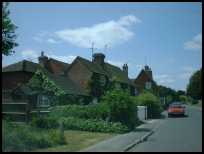 Piltdown in East Sussex is mostly heathland with sandy soils and is has very
similar flora to the Ashdown Forest .
The views to the
Piltdown in East Sussex is mostly heathland with sandy soils and is has very
similar flora to the Ashdown Forest .
The views to the 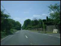 Piltdown in East Sussex has very few services with the exception of the


